 |
|
|
|
MAPS
|
||
|
Maps of Halifax County and surrounding areas and Links to Maps
|
||
|
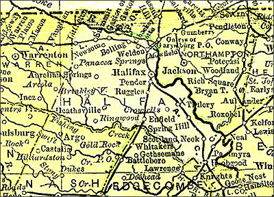
1895 Halifax County Reproduced here with permission, The 1895 Atlas Project, originally created and maintained by the late Pam Rietsch. That wonderful project is now archived on the Internet Archive. The 1895 County Maps created by the Project are absolutely fantastic and a wonderful source for research.
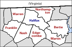
~~~~~~~~~~~~~~~~~~~~~~~~~~~~~~~~~~~~~~~~~~~~~~~~~~~~~~ Halifax and It's Neighbors
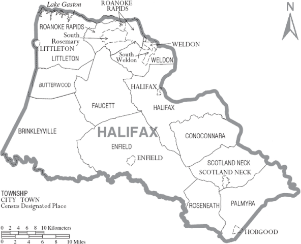
~~~~~~~~~~~~~~~~~~~~~~~~~~~~~~~~~~~~~~~~~~~~~~~~~~~~~~ Current Day Halifax County
~~~~~~~~~~~~~~~~~~~~~~~~~~~~~~~~~~~~~~~~~~~~~~~~~~~~~~
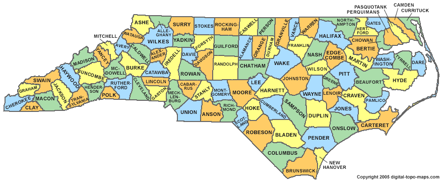
State of North Carolina
|
||
|
Links to Maps:
North Carolina Digital Maps Collection
Historical Maps of North Carolina
USGenWeb Archives Digital Map Library
Avenues of Early North Carolina Settlement
North Carolina County Formations
Transportation and Settlement in NC, 1660-1775
Virginia-North Carolina Boundary |
||
|
©2011 to present by Deloris Williams, the NCGenWeb Project, Inc., and/or individual contributors.You are free to copy records on this site for your own personal research. Last updated March 01, 2025
|