|
 |
Yancey County, North Carolina
Genealogy NCGenWeb
Project
Updated
April 02, 2023 |

|
|
|
HOME
|
|
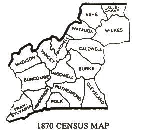
FORMATION OF YANCEY COUNTY |
|
1830 - 1920 |
|
|
|
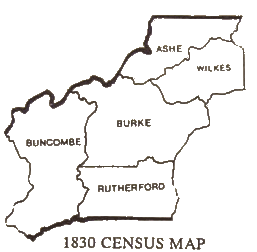
Yancey was not established at this time. Only 5
counties dominated the western NC territory.
|
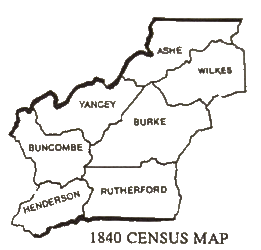
1833, Yancey County was formed out of Buncombe and
Burke lands.
|
|
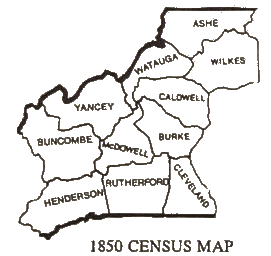
1849, Watauga was formed out of Yancey's northern
territory; southern part of Yancey was annexed to Buncombe.
|
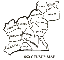
1851, Madison County was formed out of Yancey's
western area.
|
|
1861, Mitchell is formed out of northern Yancey's
territory making the county even smaller.
|
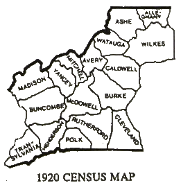
1911, Avery was formed out Mitchell; subsequently
Yancey's northern boundary with Mitchell changed.
|
|
Source: Hope Bailey, United States Census Map
1987; Cartographer William Dollarhide; additional source, Corbitt,
David, The Formation of the North Carolina Counties 1663 - 1943,
Division of the Archives and History; N.C. Historical Commission,
Raleigh, NC, 1975
|
|
  2007-Present All Rights Reserved. The information contained
herein is the property of the individual submitters. For information
about how to become a NCGenWeb county host, please visit our
volunteer page.
Yancey Co. host / webmaster is
Beth Bradford Pytel. Your
comments and suggestions are always welcomed.
2007-Present All Rights Reserved. The information contained
herein is the property of the individual submitters. For information
about how to become a NCGenWeb county host, please visit our
volunteer page.
Yancey Co. host / webmaster is
Beth Bradford Pytel. Your
comments and suggestions are always welcomed. |
|
|
|