- 1590 White-deBry Map (from Pasquotank Co. site)
- 1606 Mercator Hondius Map of the American Provinces of Virginia and also of Florida (from Pasquotank Co. site)
- 1673 Ogilby-Moxon Map of Carolina (from Pasquotank Co. site)
- 1682 Carolina Newly Described (by John Seller)
- 1690 – A New Map of Carolina (by Philip Lea)
- 1696 Carte general de la Caroline (by Nicolas Sanson)
- 1709 John Lawson Map of Carolina (From Hawks’ History of North Carolina)
- 1730 Herman Moll Map (from the Pasquotank Co. website)
- 1733 Map by Edward Mosley (from Pasquotank Co. site)
- 1738 Map by James Wimble (from Pasquotank Co. site)
- 1744 Lord Carteret’s Land Grant (from the Pasquotank Co. website)
- 1770 partial map (by Capt. John Collet)
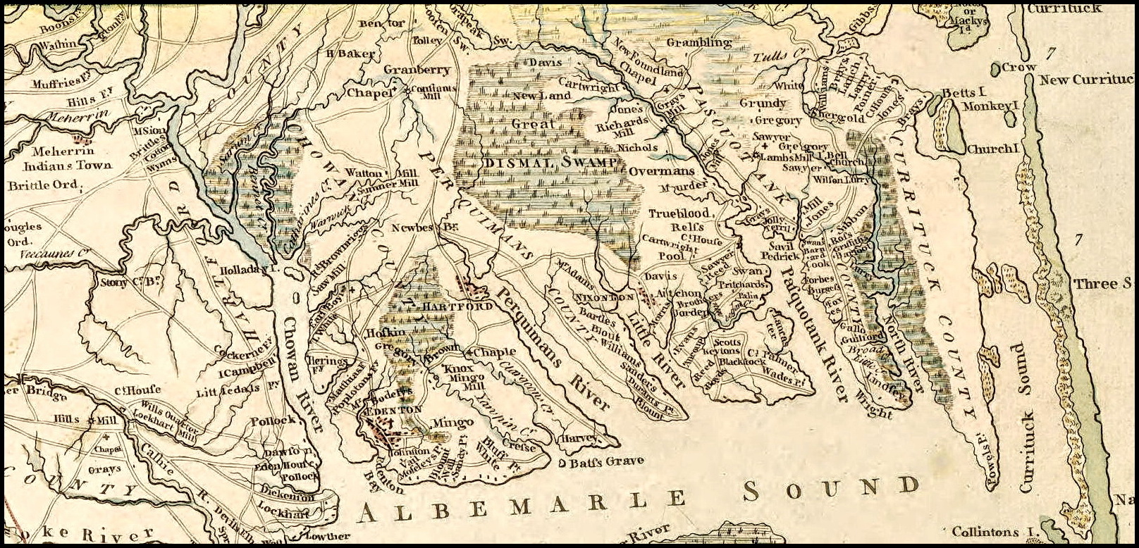
- 1775 Henry Mouzon, Jr. Map (from the Pasquotank Co. website)
- 1808 Price-Strothers Map (from the Pasquotank Co. website)
- 1833 MacRae-Brazier Map (from Pasquotank Co. site)
- Civil War Maps – (by Jeremy Francis Gilmer)
- 1882 W.C. Kerr Map of Eastern North Carolina (from Pasquotank Co. site)
- 1895 North Carolina State Map
- 1896 Postal Route Map (from Pasquotank Co. site)
- 1916 NC Highway Map (from Perquimans Co. site)
- 1926 NC Highway Map (from Perquimans Co. site)
- 1968 Chowan, Pasquotank, and Perquimans Counties (Geodetic Survey)
- Animated Atlas (From the beginning of the 13 states to present–Excellent history lesson!)
- Historical Maps of the United States (From the University of Texas at Austin)
- North Carolina County Maps various years from 1664 – 1965 (click on the different years)
- North Carolina Maps Project
- State Travel Map from the NC Dept. of Transportation (from Pasquotank Co. site)