TO ORDER MAPS SOLD BY DAVIE COUNTY HISTORICAL AND GENEALOGICAL SOCIETY, click here
- Lagle Land Grant
- Hughes Historical, 1700’s, drawn in 1977
- J.T. Alderman, 1887
- Wilson F. Merrell, 1928
ARTICLE DESCRIBING DAVIE COUNTY MAPS: click here
ONLINE MAPS:
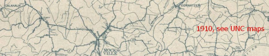
- Historic Maps online at UNC
- The North Carolina Gazetteer is online.
- Topographic Maps
- 1895 Map of North Carolina
- With Google Earth, you can see aerial views starting with 1993. At the top of the map, look for a round clock with an arrow around it. Click on that and you’ll get a slider with the years available to be seen. Some of the images are not focused real sharp, but you’ll still be able to enjoy them. To download GoogleEarth, click here. This feature is not available on GoogleEarth with iPhone or iPad.
- With Google Maps, you can create your own maps which you can save. Suggestions: mark on a map where your grandparents’ home was located, where they’re buried, where they went to school. This also gives you latitude and longitude which will be a marker for that spot in spite of changes in structures. You must have a free Google account. Google Maps is available without downloading a program. For information, click here.
HOW TO TRACE DAVIE COUNTY LAND RECORDS ONLINE
- [grantee = buyer; grantor = seller]
- www.daviencrod.org
- click the acknowledge sentence
- click Full System
- type in name and any other information you have and hit enter
- Notice four tabs; Index Search, Directory; Index/Detail; Custom List
- In Directory, click box before name
- Click Index/Detail tab
- Choose deed by clicking box at left
- Near the bottom of the screen, click Image
- To print, click icon of printer at top right
HOW TO USE DAVIE COUNTY GIS: https://gis.daviecountync.gov/webgis
Latitude and Longitude
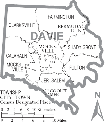
Townships, Towns, and Communities
Townships as listed on the US Census from 1790
Townships in 2016 are Calahaln, Clarksville, Farmington, Fulton, Jerusalem, Mocksville, and Shady Grove.
Towns are Bermuda Run, Cooleemee, and Mocksville (county seat).
Populated communities are Advance, Baltimore, Bermuda Run, Bixby, Bryan(t)’s Settlement, Calahaln, Cana, , Cedar Creek, Center, Clarksville, Clinton, Cooleemee, Cornatzer, County Line, Davie Academy, Davie Crossroads (Greasy Corner), Dulin, Egypt, Ephesus, Farmington, Fork, Four Corners, Fulton, Gander Hill, Goodwill Heights, Hickory Hill, Hillsdale, Holman’s Cross Roads, Hunting Creek, Ijames Cross Roads, Jericho, Jerusalem, Kappa (now called Davie Academy), Ketchie’s Mill, Kinderton, Kurfees, Main/Mainville, Marchmont, Mock’s Old Field, Mocksville, Nester, Oak Grove, Oak Valley, Oakland Heights, Pino, Redland, Rockland Heights, Shady Grove, Sheffield, Smith Grove, Stanley’s Store, Yadkin Valley