Macon County — In response to the need of the people the General Assembly of 1828 passed an act to create a new county with the name Macon in honor of Nathaniel Macon from Warren County, a respected North Carolina Senator and Speaker of the House of Representatives. This new county was formed from Haywood County and contained parts of Jackson and Swain Counties. The town of Franklin was established by an act of the General Assembly on February 10, 1855.
Franklin — The town was named for Jesse Franklin who was instrumental in guiding the course of North Carolina during the critical days after the Revolution. He served in the House Commons and in the State Senate as well as the U.S. Senate, and was governor of North Carolina in 1820 and 1821 at the time of the settlement of Franklin.
Highlands — The high plateau on which Highlands stands remained remote during the early days of Macon County’s history. Samuel Truman Kelsey and Clinton Carter Hutchinson of Reno County, Kansas selected the plateau for the development of a new town. They arrived at the site of their new town on February 1875, purchased 839 acres and began development and promotion of the area. It was to be called Kelsey’s Plateau but the name was soon changed to Highlands.
Nantahala — Nantahala is a remote community in the western part of the county about 32 miles west of Franklin. It was named by its first residents, the Cherokee Indians. The name means “Land of the Noonday Sun.”
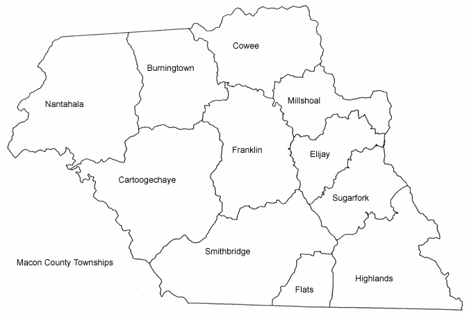
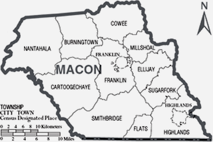
Townships — Currently Macon County consists of 11 townships: Burningtown, Cartoogechaye, Cowee, Ellijay, Flats, Franklin, Millshoal, Nantahala, Otto, Smithbridge, Sugarfork.
Leave a Reply