Montgomery County NCGenWeb

The county was named for General Richard Montgomery (1738-1775), a Revolutionary War soldier who was killed in the Battle of Quebec.
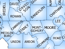
Montgomery County was formed in 1779 from Anson County. It is located in the south central part of the state, bordered by the North Carolina counties of Moore, Richmond, Stanly, Davidson & Randolph. See information on neighbor counties below.
The area of the county is 502 square miles. The population in 2000 was 26,823.
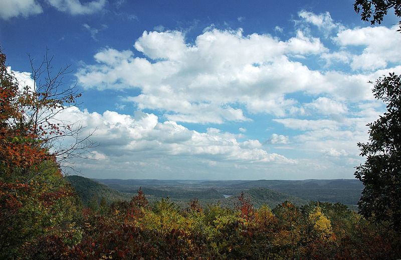
Montgomery County is a beautiful and scenic county, and is blessed with exceptional natural resources.
The Uwharrie National Forest covers a large part of the county, with Morrow Mountain State Park just to the west, across the Yadkin River in Stanly County. The Yadkin River flows south along the upper part of the Montgomery/Stanly border, forming Badin Lake above Badin Dam, and then running south to where the Uwharrie River empties into it. At that point, the two waterways form the Pee Dee River, which flows south between Montgomery and Stanly counties to Lake Tillery, and then continues south past the point where Montgomery's southwest corner meets Stanly's southeast corner and Anson County's northeast corner. The Pee Dee River flows on south, entering South Carolina and eventually emptying into the ocean at Georgetown SC. Almost all of Montgomery County lies within the Pee Dee Drainage Basin, except for a strip of land along Montgomery's eastern border.
The Town Creek Indian Mound in the southwestern part of the county is a state historical site.
North Carolina USGS Quad Topographic Features in Montgomery County
Montgomery NCGenWeb Index
Montgomery's Courthouse fire, in 1835 destroyed most of the records.
Any records before that time, may not exist
Montgomery County Records at North Carolina State Archives
Anson County Records at North Carolina State Archives
Montgomery County North Carolina, Government
Montgomery County, NC Register Of Deeds
Montgomery County Chamber of Commerce
Sandhill Regional Library System, Montgomery County
(I'm not sure that the address below is
correct, or that the society is still active.
I cannot find an internet
link for the society, even on the NCGS site.)
Montgomery County Historical Society
Box 161
Mount Gilead, NC 27366
Montgomery County Parents & Neighbors
Montgomery was created in 1779 out of Anson County, which was created in 1750 out of Bladen County. Bladen, in its own turn, was created in 1734 out of New Hanover County, created in 1729 out of Craven County. Craven was created in 1705 out of Bath County. Bath was an original NC county, eventually abolished in 1739 after giving birth to a great number of counties.
Today, Montgomery County is surrounded by:
| Rowan County | Davidson County | Randolph County |
| Stanly County | Montgomery County | Moore County |
| Anson County | Richmond County |
Rowan and Anson touch Montgomery only on a corner of their boundaries.
Stanley County was created out of Montgomery County in 1841.

This site search engine updates every Friday. It does not search the archives.
| site search by freefind | advanced |
NCGenWeb Archives Project Search
Montgomery NCGenWeb County Coordinator
If you have material to contribute or ideas to suggest, please use the link above to contact me. Thank you for your interest in Montgomery County.
last update: 01/26/2024
© NCGenWeb Project 2009 - present
except for material noted to be from copyrighted sources