Cabarrus County Federal Census Enumeration Districts
1870
| Township 1 | Rocky River | |
| Township 2 | Poplar Tent | |
| Township 3 | Deweese | |
| Township 4 | Cooks Cross Roads | |
| Township 5 | Mt. Gilead | |
| Township 6 | Faggarts | |
| Township 7 | Reed Misenheimers | |
| Township 8 | Mt. Pleasant | |
| Township 9 | Smiths | |
| Township 10 | Bethel | |
| Township 11 | Baptist Church | |
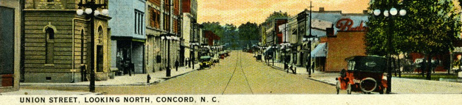
| Township 12 | Concord |
1880
| District 29 | Township 11 | Baptist Church |
| District 30 | Township 10 | Bethel |
| District 31 | Township 12 | Concord |
| District 32 | Township 3 | Deweese |
| District 33 | Township 6 | Faggarts |
| District 34 | Township 4 | Cooks Cross Roads |
| District 35 | Township 5 | Mt. Gilead |
| District 36 | Township 7 Township 8 | Reed, Misenheimers, Mt. Pleasant |
| District 37 | Township 9 | Smiths |
| District 38 | Township 2 | Poplar Tent |
| District 39 | Township 1 | Rocky River |
1900
| District 13 | Township 1 | Rocky River |
| District 14 | Township 2 | Poplar Tent |
| District 15 | Township 3 | Deweese |
| District 16 | Township 4 | Cooks Cross Roads |
| District 17 | Township 5 | Mt. Gilead |
| District 18 | Township 6 Township 7 | Faggarts, Reed, Misenheimers |
| District 19 | Township 8 | Mt. Pleasant |
| District 20 | Township 9 | Smiths |
| District 21 | Township 10 | Bethel Church |
| District 22 | Township 11 | Baptist Church |
| District 23 | Township 12 | Concord City, Ward 1, Ward 4 |
| District 24 | Township 12 | Concord City, Ward 2, Ward 3 |
1910
| District 35 | Township 1 | Rocky River |
| District 36 | Township 2 | Poplar Tent |
| District 37 | Township 3 | Deweese |
| District 38 | Township 4 | Cooks Cross Roads |
| District 39 | Township 5 | Mt. Gilead |
| District 40 | Township 6 | Faggarts |
| District 41 | Township 7 | Reed Misenheimers |
| District 42 | Township 8 | Mt. Pleasant |
| District 43 | Township 9 | Smiths |
| District 44 | Township 10 | Bethel Church |
| District 45 | Township 11 | Baptist Church |
| District 46 | Township 12 | Concord City Ward 1 (part of) All north of Bleachery, Cedar andFranklin streets to their intersection with Duval and Beach streets |
| District 47 | Township 12 | Concord City Ward 1 (part of) All south of Bleachery, Cedar andFranklin streets to their intersection with Duval and Beach streets |
| District 48 | Township 12 | Concord City Ward 2 (part of) All west of North Church Street |
| District 49 | Township 12 | Concord City Ward 2 (part of) All east of North Church Street |
| District 50 | Township 12 | Concord City Ward 3 |
| District 51 | Township 12 | Concord City Ward 4 (part of) All south of Young and Calvin streets to their intersection of Spring Street |
| District 52 | Township 12 | Concord City Ward 4 (part of) All north of Young and Calvin streets to their intersection of Spring Street |
1920
| District 39 | Township 1 | Rocky River |
| District 40 | Township 2 | Poplar Tent (part of) Voting precinct 1 |
| District 41 | Township 2 | Poplar Tent (part of) Voting precinct 2 |
| District 42 | Township 3 | Deweese |
| District 43 | Township 4 | Cooks Cross Roads (part of) All north of the line beginning at Buffalo Creek; thence with Bethpage Road to J. W. Cannon’s line on Old Bradshaw line; thence with J. W. Cannon’s line to RowanCounty line |
| District 44 | Township 4 | Cooks Cross Roads (part of) All south of the line beginning at Buffalo Creek; thence with Bethpage Road to J. W. Cannon’s line on Old Bradshaw line; thence with J. W. Cannon’s line to RowanCounty line |
| District 45 | Township 5 | Mt. Gilead including County Home (Paupers) |
| District 46 | Township 6 | Faggarts |
| District 47 | Township 7 | Reed Misenheimers |
| District 48 | Township 8 | Mt. Pleasant excluding Mt. Pleasant town |
| District 49 | Township 8 | Mt. Pleasant town |
| District 50 | Township 9 | Smiths |
| District 51 | Township 10 | Bethel Church |
| District 52 | Township 11 | Baptist Church (part of) All east of Southern RR |
| District 53 | Township 11 | Baptist Church (part of) All west of Southern RR |
| District 54 | Township 12 | Concord (part of) including Concord city Ward 1 (part of) Bounded by: McGill, West Buffalo, North Union, West March, Crowell, Cedar, Pine, Bleachery, Bleachery extended City limits |
| District 55 | Township 12 | Concord (part of) comprising Concord city Ward 1 (part of) Bounded by: Bleacher extended, Bleacher, Pine, Cedar, Crowell, W March, North Union, West Depot, City limits |
| District 56 | Township 12 | Concord (part of) including Concord City Ward 2 (part of) Bounded by: City limits, St George, Simpson, Pearl, Church, Gordon, North Union, West Buffalo, McGill |
| District 57 | Township 12 | Concord (part of) comprising Concord City Ward 2 (part of) Bounded by: Gordon, Church, Pearl, Simpson, St. George, City limits, East Depot North Union |
| District 58 | Township 12 | Concord (part of) comprising Concord City Ward 3 Bounded by: East Depot ,City limits, City limits, South Union |
| District 59 | Township 12 | Concord (part of) comprising Concord City Ward 4 (part of) Bounded by: West Depot, South Union, Ford, South Spring, Ring, Pounds, Young, Young extended, City limits |
| District 60 | Township 12 | Concord (part of) comprising Concord City Ward 4 (part of) Bounded by: Young extended, Young, Pounds, Ring, S Spring, Ford, South Union City limits |
1930
| District 1 | Township 1 | Rocky River (north part) |
| District 2 | Township 1 | Rocky River (south part) |
| District 3 | Township 2 | Poplar Tent (west part) |
| District 4 | Township | Poplar Tent (east part) and Norcott Cotton Mill Village |
| District 5 | Township 3 | Deweese |
| District 6 | Township 4 | Cooks Cross Roads (part) |
| District 7 | Township 4 | Cooks Cross Roads (part) bounded by (N) county line; (SE) railroad tracks; (SW) W 1st N Maple Elm; includes KannapolisVillage (part) |
| District 8 | Township 4 | Cooks Cross Roads (part) bounded by (N) county line; (E) N Rose Ave Extended, N Rose Ave, S Rose Ave, east “C” Front, east “D” York; (S) east “F”; (W) railroad tracks; includes Kannapolis Village (part) |
| District 9 | Township 4 | Cooks Cross Roads (part) bounded by (N) Elm, N Maple, W 1st; (E) railroad tracks; (S) West “H” extended, West “H”, Mulberry, Vance, West “E”, Chestnut, West “D” S Poplar, West “C”; (W) county road to county line; includes Kannapolis Village |
| District 10 | Township 4 | Cooks Cross Roads (part) bounded by (N) Township Line; (E) Township Line; (S) East “B”, Patterson-Smith’s Chapel-Kannapolis Rd, East “B”; (W) railroad tracks; includes Kannapolis Village (part) |
| District 11 | Township 4 | Cooks Cross Roads (part) bounded by (N) Yance extended, Yance, West “B”, Chestnut, W Forest, W Forest extended; (S) railroad tracks; (S) Concord City limits, Township Line; (W) Irish Buffalo Rd; includes Kannapolis Village (part) |
| District 12 | Township 4 | Cooks Cross Roads (part) bounded by (N) East “B”, Kannapolis-Smith’s Chapel-Patterson Rd; (E) Township Line; (S) Concord City limits; (W) railroad tracks; includes Kannapolis Village (part) |
| District 13 | Township 5 | Mt. Gilead |
| District 14 | Township 6 | Faggarts |
| District 15 | Township 7 | Reed Misenheimers |
| District 16 | Mt. Pleasant town | |
| District 17 | Township 8 | Mt. Pleasant excluding Mt. Pleasant town |
| District 1 | Township 9 | Smiths |
| District 19 | Township 10 | Bethel Church (northwest part) |
| District 20 | Township 10 | Bethel Church (southwest part) |
| District 21 | Township 11 | Baptist Church (west part) and Franklin Mill Village |
| District 22 | Stonewall Jackson Manual Training and Industrial School | |
| District 23 | Township 11 | Baptist Church (east part) |
| District 24 | Township 12 | Concord City Ward 1 bounded by (N) Ward line W Buffalo; (E)N Union; (S) W Depot; (W) city limits |
| District 25 | Township 12 | Concord City Ward 2 bounded by (N) city limits; (E) city limits; (S) E Depot; (W) N Union, W Buffalo, N Church |
| District 26 | Township 12 | Concord City Ward 3 bounded by (N) E Depot; (E) city limits; (S) city limits; (W) S Union |
| District 27 | Township 12 | Concord City Ward 4 bounded by (N) W Depot; (E) S Union; (S) city limits; (W) city limits |
| District 28 | Township 12 | Concord City Ward 5 bounded by (N) city limits; (E) N Church; (S) W Buffalo Ward line; (W) city limits |