Collet Map of North Carolina, 1770
Click on the upper right quadrant to get the right section, and then enlarge further by clicking on the image. Look for the area between “Charlottesburgh” and Salisbury, drained by Rocky River and Cold Water Creek.
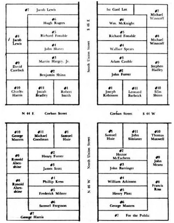
map of first landowners of Concord; source unknown
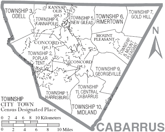
map of Cabarrus with municipal and township labels
1850 Mitchell Map of North Carolina, showing Gold Regions