|
Map Features in Tyrrell County (from TopoZone)
Map Features in Martin County (from TopoZone)
Formed from Tyrrell County and Halifax County in 1774.
Map Features in Washington County (from TopoZone)
Formed from Tyrrell County in 1799.
Map Features in Dare County (from TopoZone)
Formed from Tyrrell County, Currituck County and Hyde County in 1870.
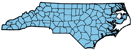
The following will provide a map of Tyrrell County. You can zoom in on
this map by selecting the zoom feature and then clicking on the point
you want to zoom on. Additional roads and water features will be displayed
as you zoom in.
Map of Tyrrell County (from Tiger Mapping Service)