|
The following images were included in a MS PowerPoint presentation used by North Carolina
Geological Survey geologists from the Asheville Regional Office at many public landslide outreach
meetings. The presentation has been adapted to the Internet for broader distribution. This page is
on "Rock Slope Stability."

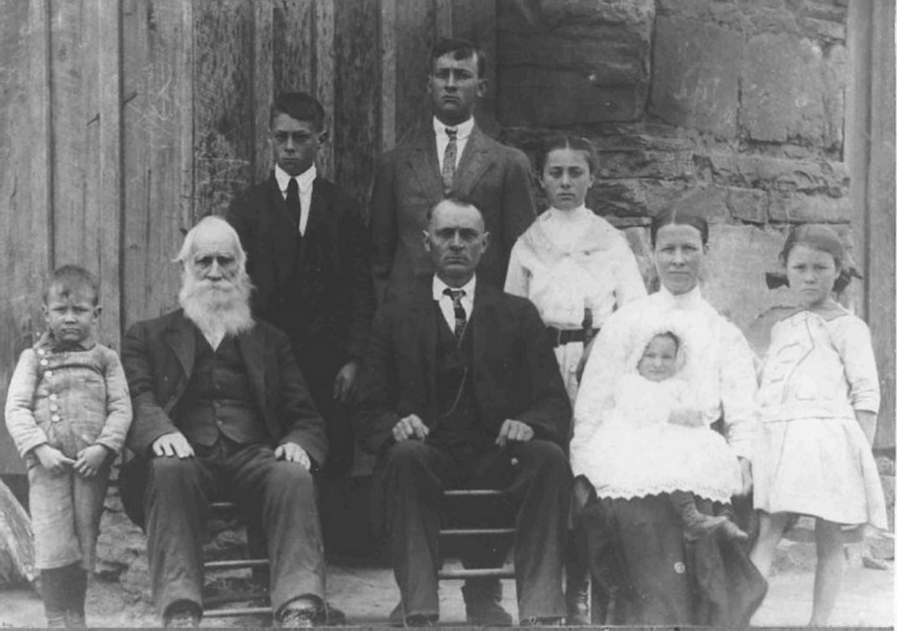
Landslides and landslide related fatalities from the mid-July 1916 hurricane in Transylvania
County, NC. Damage from landslides and flooding occurred over much of the south-central mountain
area. The July 15-16, 1916 flood is considered the flood of record in western North
Carolina.

Color-infrared aerial photograph of the Gorges State Park area, Transylvania County, North Carolina
showing mapped locations of deposits left by the catastrophic failure of Lake Toxaway Dam on August
13, 1916. The dam failure triggered a debris flow along the Toxaway River that traveled over 7
miles and into South Carolina. Lake Jocassee is underlain by cobble, gravel and sand deposits from
the flood. The original dam was in about the same location as the current dam. The quote shown is
from S.W. McCallie, State Geologist of Georgia at the time. Studies by the North Carolina
Geological Survey estimate that the outflow just below the dam was on the order of 293,938 cfs
(discharge) and 50 mi/hr (velocity). Information from Geology of Gorges State Park, N.C. Geological
Survey Information Circular 31.

Top: View looking downstream along the Toxaway River below the dam showing the assumed scour lines
and the location of cross section D (bottom) used to reconstruct the super elevation angle of the
dam failure torrent. This information goes into computing an estimated velocity and discharge of
the outflow.

Top Left: 60-foot long boulder weighing nearly 900 tons transported by the flood waters along the
Toxaway River from the August 13, 1916 Lake Toxaway Dam failure. Photograph taken about 0.5 miles
downstream from Toxaway Falls. Top Right. Imbricated boulders at the crest of the boulder levee
shown in red in the cross section at Bottom Left. Bottom Right. Photograph of the contact (shown by
arrow) of the boulder flood deposits overlying pre-existing flood plain deposits along the Toxaway
River.

Left: Detailed map of a ~4 acre active weathered-rock slide along the Toxaway River in Gorges State
Park. This slow-moving landslide was probably triggered by the 1916 dam failure torrent that eroded
and over-steepened the slope along the river. Right: Tree ring studies of trees on and off the
slide indicate a period of slide movement during the 1965-1974 timeframe corresponding to a period
of above average rainfall. Tree ring studies were done cooperatively with the U.S.F.S. Coweeta
Hydrologic Laboratory, Otto, N.C. Information contained in Geology of Gorges State Park, N.C.
Geological Survey Information Circular 31.

Trees growing on an active landslide are commonly curved. The tree tilts with the moving slide, and
over time attempts to regain vertical growth resulting in the curved trunk. A and B. Curved trees
showing the effects of movement on the Toxaway River weathered-rock slide. White arrow points to
person for scale in photo A (left).

Field developed cross section view of the Toxaway River weathered-rock slide in Gorges State Park.
Information contained in Geology of Gorges State Park, N.C. Geological Survey Information Circular
31.

Left: Example of landslide hazard mapping. Slope movements (landslides), flood and
other surficial deposits mapped in Gorges State Park by the N.C. Geological Survey.
Right: Bedrock geologic map of Gorges State Park. Mapping landslides and surficial units
along with bedrock provides the best geologic framework for constructing landslide hazard maps.
Information contained in Geology of Gorges State Park, N.C. Geological Survey Information Circular
31.
Center: Schematic block diagram showing the relationships between bedrock structure,
streams, and slope movements for Gorges State Park, Transylvania County, N.C.
 Back to Top Back to Top
For additional information about landslide hazards in North Carolina, please
contact Mr. Richard Wooten with their Asheville Regional Office:
2090 U. S. Highway 70,
Swannanoa, North Carolina 28778.
828-296-4632
http://www.geology.enr.state.nc.us/Default.htm
Rick.Wooten@ncdenr.gov
|


